

The Stratigraphy of the Million Dollar Beach Site

One of the first things archaeologists seek to understand when they are investigating a site is the stratigraphy. This entails both documentary research and ground-truthing through test excavations like shovel test pits (STPs) or small excavation units. At its most basic, stratigraphy is important to understanding a site because it can help the archaeologist understand the relative age of artifacts to each other, as well as demonstrate which artifacts are associated with each other and which artifacts are not. It is a key factor in building context, the most important concept in archaeological interpretation. Before continuing on to a discussion of the stratigraphy at the Million Dollar Beach Site, let’s talk a little bit more about these important archaeological concepts.

Figure 1: Three Laws of Stratigraphy
Stratigraphy is the analysis of strata or soil layers. Some areas, like rocky escarpments, may have very limited or no soil and others, like active flood plains, may have dozens of feet before you’d reach bedrock. In the latter situation, sediment deposited by flooding and acted upon by other natural processes like weathering and the movement of organic material, can result in tremendous soil buildup over time. In the former, sediment buildup may be limited to only wind action or erosion from above. What’s important in this discussion is the understanding that the layers archaeologists dig through were created through time, by processes that we can witness today, and these processes were operating in the same way in the past. This means that, barring unusual circumstances, the deeper a soil layer is within an excavation, the older it is.
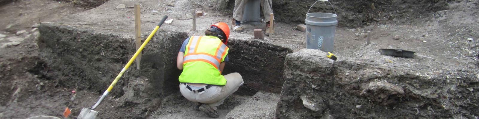
Context and Association are the two most important concepts in archeology. Put simply, they ask, where was an object (or feature or site) found and what was found with it? For an archaeologist to make an educated interpretation about what an artifact means, they need to know as much as possible about where that artifact is from and what was found alongside it. Artifacts that have been removed from their context and associations through natural (erosion or animal burrowing) or cultural (construction, looting, and collecting) processes are divorced from their meaning and the vast majority of their scientific value. Because of this, the most important tool an archaeologist wields is not the shovel, the trowel, or the brush, but a pencil and paper. When conducting any form of excavation, archaeologists take copious amounts of notes and photographs, documenting as much about the stratigraphy, context, and association of every artifact they encounter, no matter how seemingly insignificant some of them might be. You can never know what will be important or what information you will and won’t need until excavations are complete, you’re back in your office compiling the results, and it’s too late to go back.

Figure 2: Soil Map of Million Dollar Beach Vicinity
Understanding the stratigraphy of the Million Dollar Beach Site helps us to build a case for the context and associations of the artifacts we find there. This process began even before we set foot in the field by researching what soils we should expect. Figure 2 is an image taken from the National Resource Conservation Service’s Web Soil Survey application. It documents the types of soils identified in the vicinity of the Million Dollar Beach Site. This gives an idea of what to expect when we get into the [Text Box: Figure 2: Soil Map of Million Dollar Beach Vicinity] [msImage_20131030_07020607615_10] field and can supply crucial information regarding how deep testing needs to be to exhaust the possibility of deeply buried cultural levels. However, this information cannot be simply taken at face value. The boundaries of these soil types are often approximate and small variations might be obscured by the larger soil type patterns. Another reason to be mindful that experiences in the field may differ from published soil surveys is demonstrated at Million Dollar Beach. The soil type circling Million Dollar Beach Parking Lot and another construction lot next to it is, “Udorthents” (Map Symbol Ud), a soil type that indicates significant disturbances like cutting and filling. However, simply being listed as disturbed is not enough to write-off an area and, in fact, at Million Dollar Beach we found that the disturbance to this area was primarily filling, which rather than damage the site, often served to protect it by burying it deeper beneath modern human activities.
At the Million Dollar Beach Site there are two main divisions to the soils we encountered: natural soils, and soils that were affected by some sort of modern disturbance. The first set of soils includes most of the site and the majority of the campground area. The second set of soils includes the parking lots, road, median, and many smaller disturbances associated with electrical lines, drainage features, and roads and paths going through the campground. In the natural areas, we encountered three main soil levels, as demonstrated in Figure 3, which is typical of the profiles we encountered at the site. The first level was usually described as a very dark brown silty sand, usually with a level of humic build up on top of it, that extended to a depth of about 25 centimeters (10 inches). The second level was usually described as a strong brown coarse sand that extended another 10 inches on average. Underneath these two levels was a pale brown coarse sand level that extended at least another 30cm (12 inches) and often farther. This level became increasingly dark, wet, and included increasing numbers of small pebbles and cobbles before excavation was usually stopped by the appearance of the water table. On average, the units were dug to around 80cm (2.5 feet) before being stopped by water. This typically happened well into the third natural level and underneath artifact-bearing strata. Ground water was typically shallower to the north and east of the project area, and sometimes water was encountered very early in the units closest to the lake and the creek (see Figure 4).


Disturbed soils ranged in their appearance and form and included long, linear features created by buried electrical lines to large pit features which included a fifty-year-old septic tank. One particular disturbance that deserves further mention here is the work done around the road as it demonstrates the importance of not assuming that you know the stratigraphic conditions before excavation.

Figure 5. Construction Fill
It was deemed likely during the initial set up of the survey that identified the Million Dollar Beach Site that the areas underneath the road, parking lot, and median between the two would have been heavily disturbed by their construction and therefore, even if the original soil was still there, which is often not the case with large construction projects, that the soils would be hopelessly mixed, destroying the stratigraphy, context, and association of any artifacts that were there. Upon testing though, we discovered that not only were the soils still intact and therefore the artifacts still in situ (undisturbed or left in place) but that the filling of different soils on top of the natural ones actually helped protect it. More recent disturbances were often confined to these upper, unnatural levels, rather than dug into the natural levels below. Figure 5 shows an example of this stratigraphy, with artificially deposited white and gray soil levels on top of the same three natural levels identified almost everywhere else on site. One other point to mention in this scenario is that there were also prehistoric artifacts in the fill levels, indicating that while filling may have helped protect the Million Dollar Beach Site, at wherever this fill was from, a different archaeological site was damaged.
Million Dollar Beach Site
Archaeological Excavations in the Village of Lake George, NY
The Million Dollar Beach Site is a multi-component archaeological site directly adjacent to the famous waterfront in the Village of Lake George. Limited excavations of the site toward the goal of better preserving it in place while maintaining use of the beach parking lot, road, and campground, are currently underway in a collaborative effort between the New York State Museum’s Cultural Resource Survey Program and the Department of Environmental Conservation.
Project Directors: Barry Dale, Aaron Gore and Steve Morange