

Geographic Information System (GIS)
The datasets of the NYS Museum which are posted here are made freely available. Use of this data implies you understand the disclaimer associated with it. Our Metadata references are available from the NYS GIS Clearinghouse.
See Also

Boundary Data
This Index Map shows ArcGIS Pro coverages for the State of New York. Statewide coverages are "clipped" to the boundaries at 1:250,000 scale.
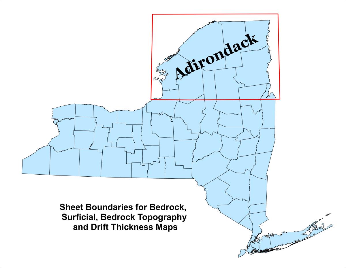
Boundary Adirondacks
Adirondack_Boundary.zip (2.98 KB)- Map Type: boundary
- Region: Statewide
- Scale: 1:250,000
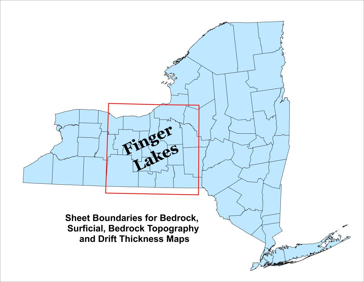
Boundary Finger Lakes
FingerLakes_Boundary.zip (3.04 KB)- Map Type: boundary
- Region: Statewide
- Scale: 1:250,000
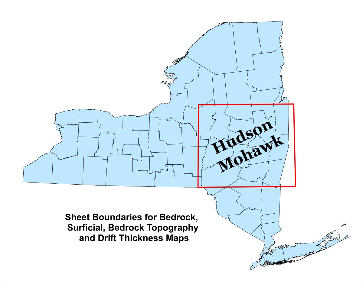
Boundary Hudson Mohawk
HudsonMohawk_Boundary.zip (3.04 KB)- Map Type: boundary
- Region: Statewide
- Scale: 1:250,000
Boundary Lower Hudson
LowerHudson_Boundary.zip (3.04 KB)- Map Type: boundary
- Region: Statewide
- Scale: 1:250,000
Boundary Niagara
Niagara_Boundary.zip (2.87 KB)- Map Type: boundary
- Region: Statewide
- Scale: 1:250,000
Surficial Geology Shapefiles
Adirondacks Surficial Sheet
Adirondack_Surficial.zip (4.9 MB)- Map Type: surfgeology
- Region: Statewide
- Scale: 1:250,000
Finger Lakes Surficial Sheet
FingerLakes_Surficial.zip (3.19 MB)- Map Type: surfgeology
- Region: Statewide
- Scale: 1:250,000
Hudson Mohawk Surficial Sheet
HudsonMohawk_Surficial.zip (4.38 MB)- Map Type: surfgeology
- Region: Statewide
- Scale: 1:250,000
Lower Hudson Surficial Sheet
LowerHudson_Surficial.zip (2.45 MB)- Map Type: surfgeology
- Region: Statewide
- Scale: 1:250,000

Niagara Surficial Sheet
Niagara_Surficial.zip (2.33 MB)- Map Type: surfgeology
- Region: Statewide
- Scale: 1:250,000
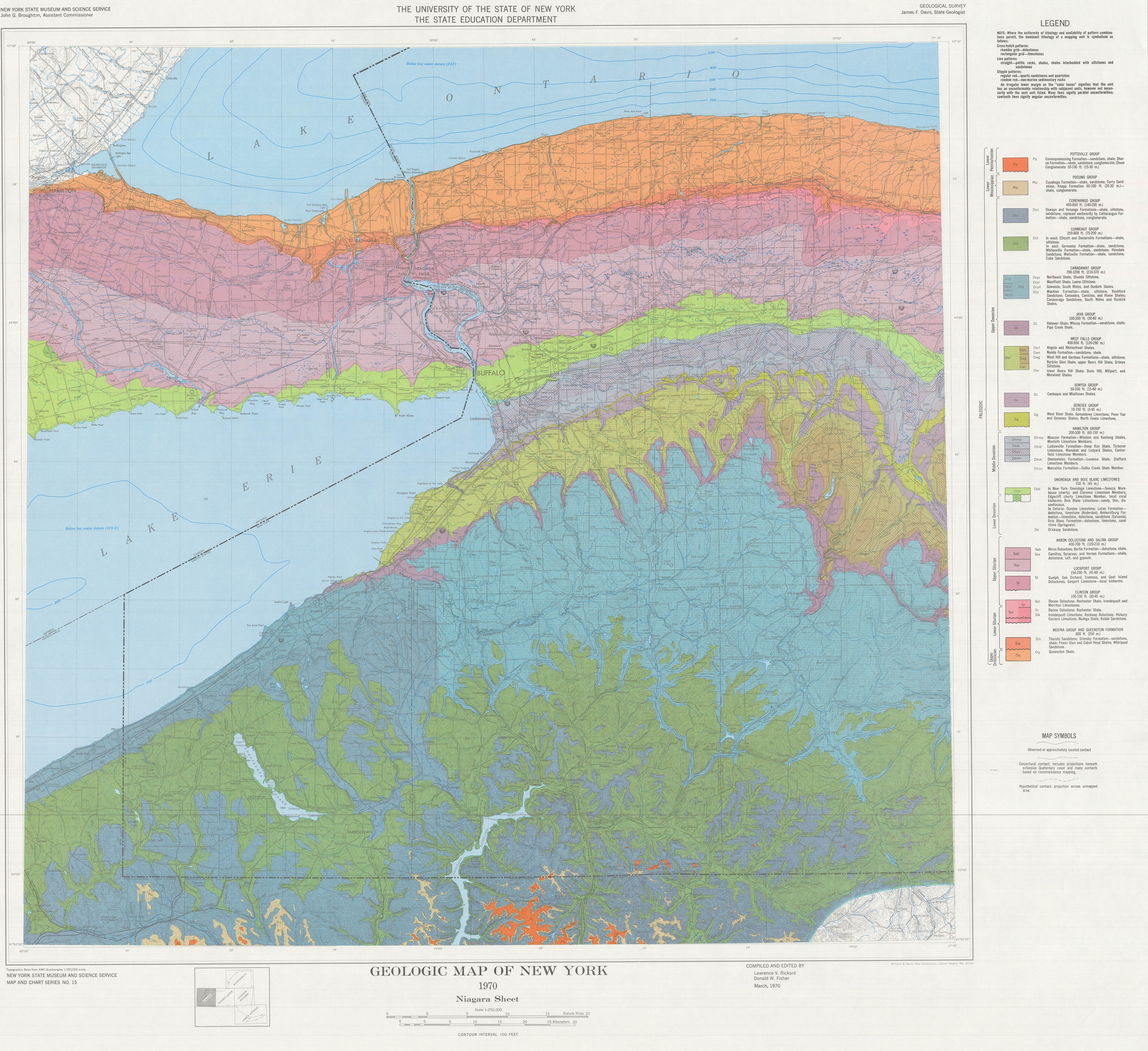
Bedrock Geology Shapefiles

Adirondack Bedrock Sheet
Adirondack Bedrock Sheet (2.21 MB)- Map Type: bedgeology
- Region: Statewide
- Scale: 1:250,000
Finger Lakes Bedrock Sheet
Finger Lakes Bedrock Sheet (1.31 MB)- Map Type: bedgeology
- Region: Statewide
- Scale: 1:250,000
Hudson Mohawk Bedrock Sheet
Hudson Mohawk Bedrock Sheet (2.01 MB)- Map Type: bedgeology
- Region: Statewide
- Scale: 1:250,000

Lower Hudson Bedrock Sheet
Lower Hudson Bedrock Sheet (1.53 MB)- Map Type: bedgeology
- Region: Statewide
- Scale: 1:250,000

Master Legend (JPG only)
Bedrock_Master_Legend.zip (21.93 MB)- Map Type: bedgeology
- Region: Statewide
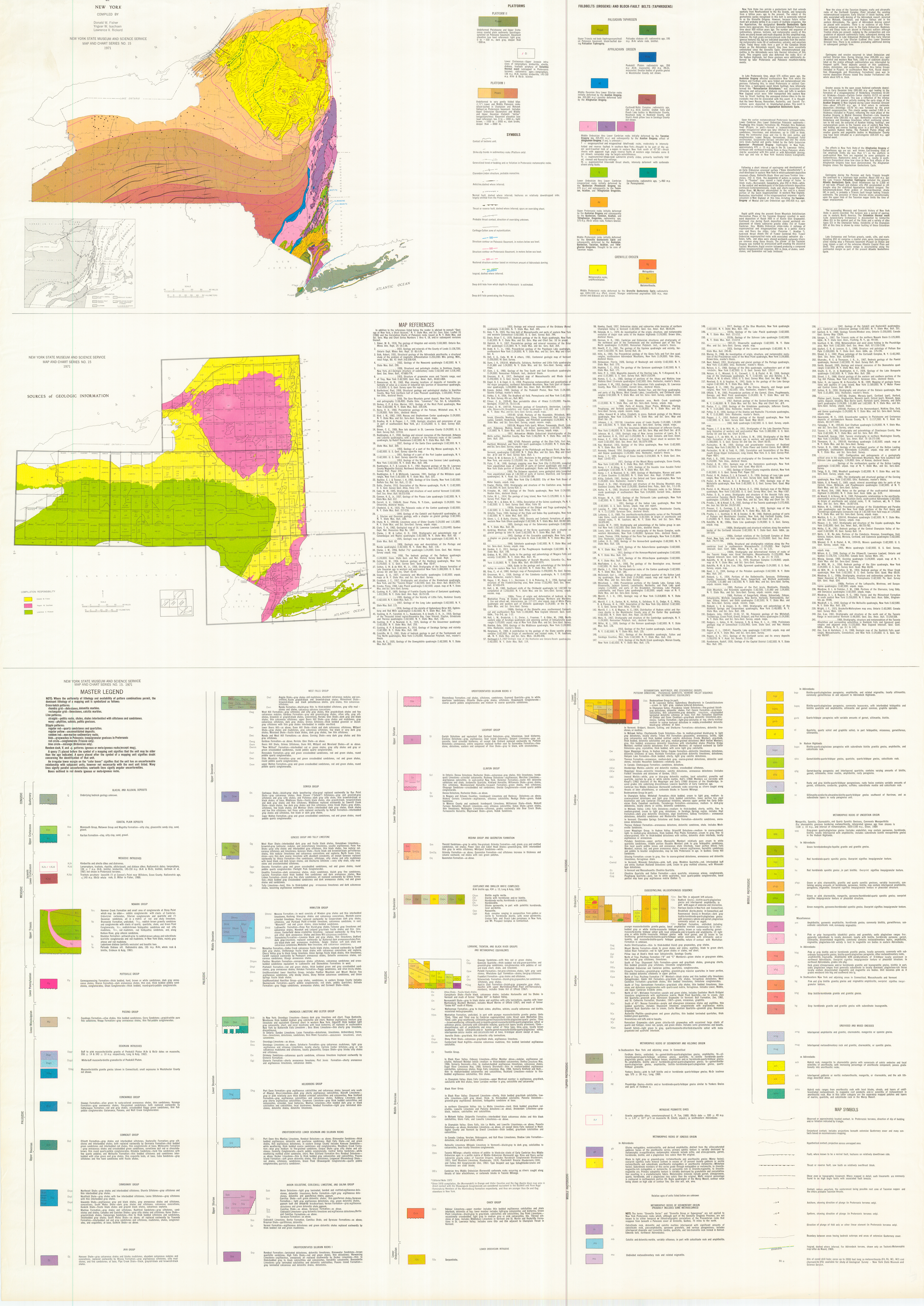
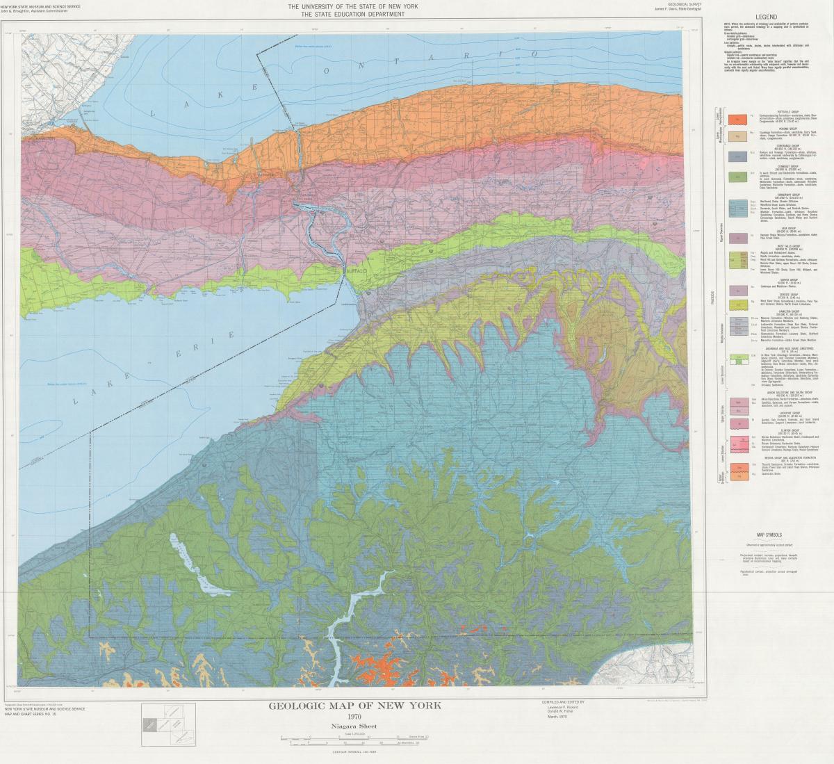
Niagara Bedrock Sheet
Niagara Bedrock Sheet (574.81 KB)- Map Type: bedgeology
- Region: Statewide
- Scale: 1:250,000
Statewide Geologic Reference Maps
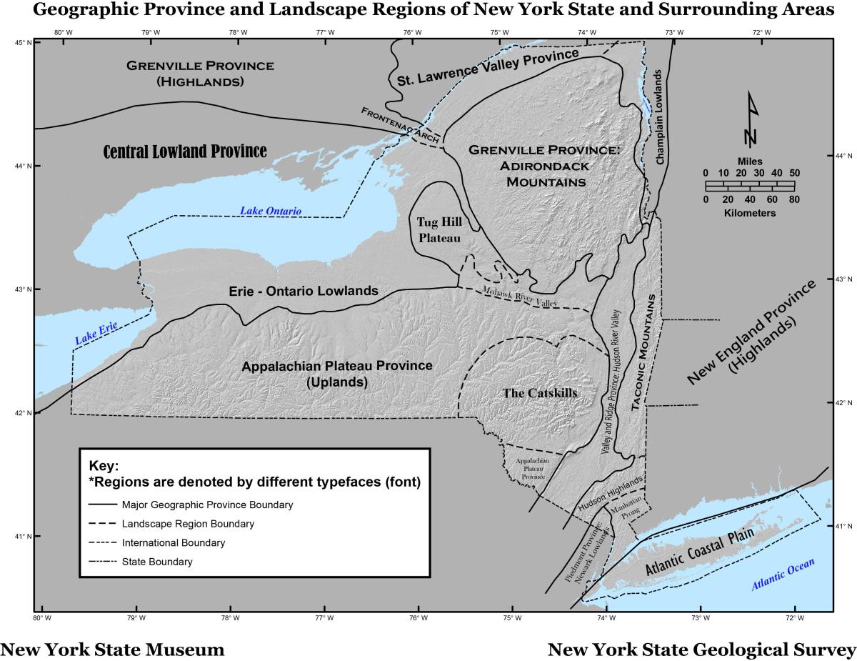
Physiographic Province Map of NY
NYS_PhysiographicProvinces.zip (252.62 KB)- Map Type: physiographic
- Region: Statewide

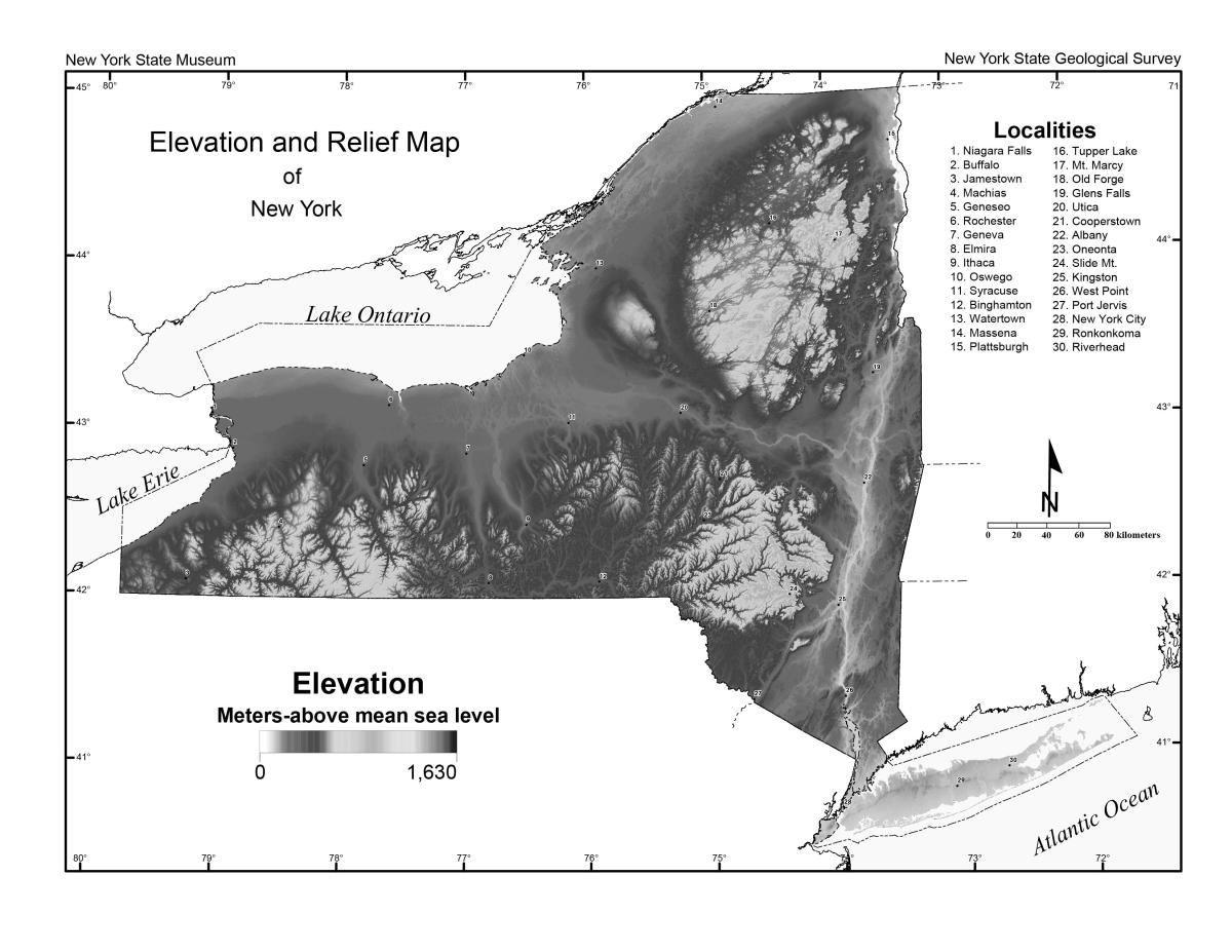
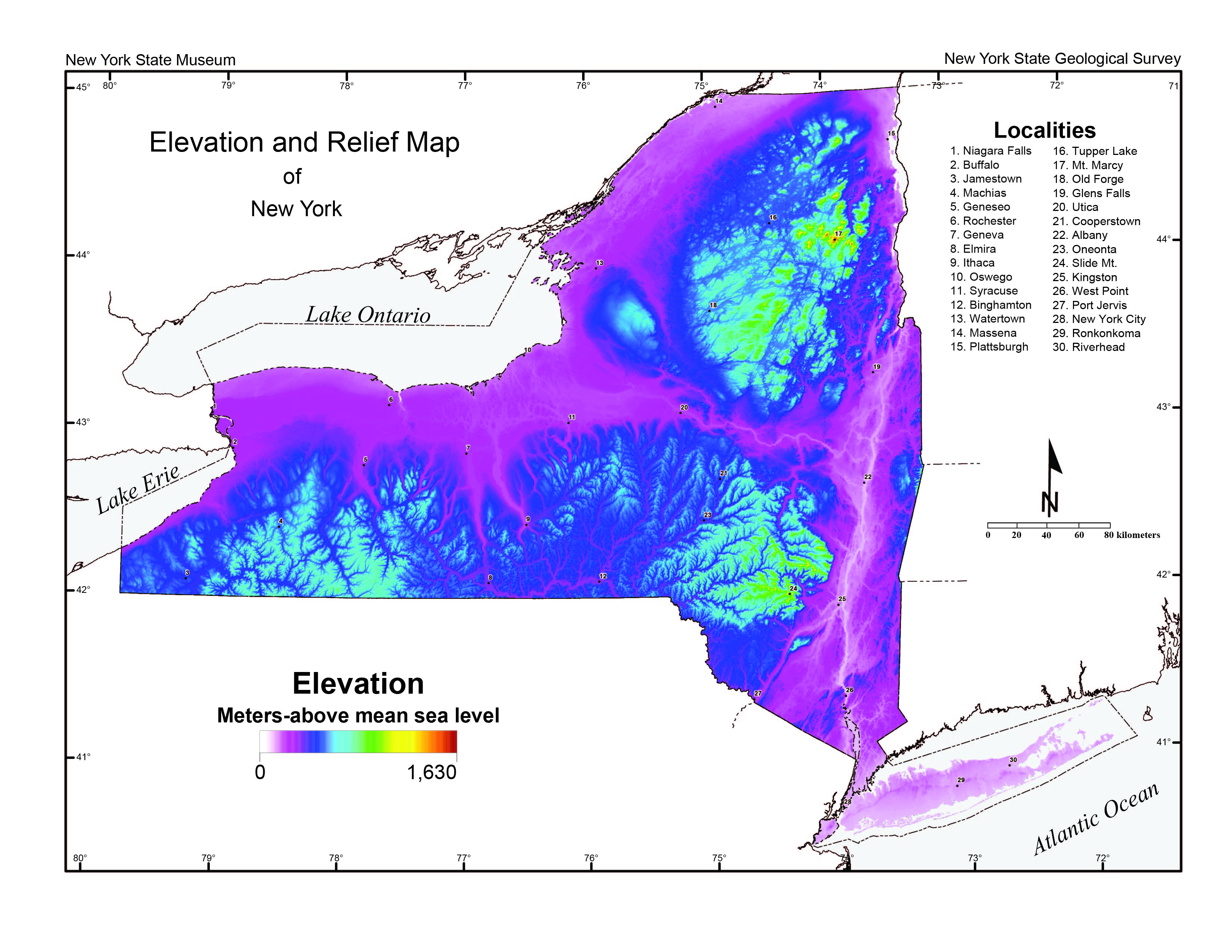
Shaded Relief Map of NYS (Greyscale)
NYS_ShadedRelief_Greyscale.pdf (941.69 KB)- Map Type: physiographic
Disclaimer
While every effort has been made to insure the integrity of this digital data, the New York State Education Department ("NYSED") makes no representation or warranty, expressed or implied, with respect to its accuracy, completeness, or usefulness for any particular purpose or scale. NYSED assumes no liability for damages resulting from the use of any information, apparatus, method or process disclosed in this dataset, map or text, and urges independent site-specific verification of the information contained herein. Any use of trade, product or firm names is for descriptive purposes only and does not imply endorsement by NYSED.