


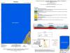
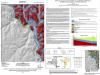
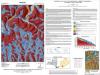
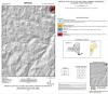
Map & Chart Series
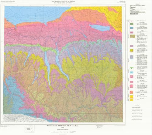
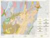
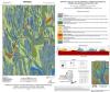
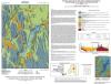
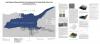
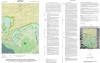
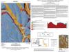
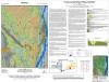
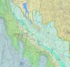
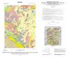
The Map and Chart Series, first introduced in 1960, combines large format graphics with associated text with emphasis on the graphic in lieu of descriptive text. The primary purpose of the series is to document surface and subsurface geologic data that are difficult to present in other formats. Many geologic maps are published in this series. Since 2006 geologic mapping at the New York State Museum has benefitted from cooperative federal partnerships. Traditional geologic mapping has been enhanced by technological developments such high resolution LIDAR terrain models. Many products contain both a surface map of geologic formations and materials as well as subsurface geologic cross sections. As you select a particular title or map you will have the option to open and download a high resolution PDF file. If you would like to request full-sized printed maps please contact Mr. Brad Seymour at Brad.Seymour@nysed.gov. For older versions of the geologic maps below, please contact Mr. Karl Backhaus at Karl.Backhaus@nysed.gov. Any questions on the digital data or geology, please contact staff members under the Geology Contact tab.
See Also
| Preview | Volume | File | Link to edit Media |
|---|---|---|---|

|
0.1 | ||

|
0.2 | ||

|
0.3 | ||

|
0.4 | ||
|
1 | ||
|
5 | ||
|
6 | ||
|
7 | ||
|
8 | ||
|
9 | ||
|
10 | ||
|
11 | ||

|
12 | ||
|
13 | ||
|
14 | ||
|
15 | ||
|
16 | ||
|
17 | ||
|
18 | ||
|
19 | ||
|
20 | ||

|
21 | ||
|
23 | ||
|
24 | ||
|
25 | ||
|
26 | ||
|
27 | ||
|
28 | ||
|
29 | ||
|
30 | ||
|
31 | ||
|
32 | ||
|
33 | ||
|
34 | ||

|
35 | ||
|
36 | ||
|
37 | ||
|
38 | ||
|
39 | ||

|
40 | ||
|
41 | ||
|
42 | ||
|
43 | ||
|
44 | ||
|
45 | ||
|
46 | ||
|
47 | ||
|
48 | ||
|
49 | ||

|
50 | ||
|
51 | ||
|
52 | ||
|
53 | ||

|
54 | ||
|
55 | ||
|
56 | ||
|
57 | ||
|
58 | ||
|
59 | ||

|
60 | ||
|
61 | ||
|
62 | ||
|
63 | ||

|
64 | ||

|
65 | ||
|
66 | ||
|
67 | ||
|
68 | ||

|
69 | ||
|
70 | ||
|
71 | ||
|
72 | ||
|
73 | ||
|
74 | ||
|
75 | ||
|
76 | ||
|
77 | ||
|
78 | ||
|
79 | ||
|
80 | ||
|
81 | ||
|
82 | ||
|
83 | ||
|
84 | ||
|
85 | ||
|
86 | ||
|
87 | ||
|
88 | ||
|
89 | ||
|
90 | ||
|
91 | ||
|
92 | ||
|
93 | ||
|
94 | ||
|
95 | ||
|
96 | ||
|
97 | ||

|
98 | ||
|
99 | ||
|
100 | ||
|
101 | ||
|
102 | ||
|
103 | ||
|
104 | ||
|
105 | ||
|
106 | ||
|
107 | ||
|
108 | ||
|
109 | ||
|
110 | ||

|
111 | ||
|
112 | ||
|
113 | ||

|
114 | ||
|
115 | ||

|
116 | ||
|
117 | ||
|
118 | ||

|
119 | ||
|
120 | ||
|
121 | ||
|
123 | ||
|
124 | ||
|
125 | ||
|
126 | ||
|
127 | ||

|
128 | ||
|
129 | ||
|
130 | ||
|
131 | ||
|
132 | ||

|
133 | ||
|
134 | ||

|
135 | ||
|
136 | ||

|
137 | ||
|
139 | ||
|
140 | ||

|
141 | ||

|
142 | ||

|
143 | ||
|
144 | ||
|
145 | ||

|
146 | ||

|
147 | ||

|
148 | ||
|
149 | ||
|
150 | ||
|
151 | ||

|
152 | ||

|
153 | ||
|
154 | ||

|
155 | ||

|
157 | ||

|
159 | ||

|
160 | ||
|
161 | ||

|
162 | ||

|
165 | ||

|
166 | ||
|
167 | ||

|
168 | ||

|
169 | ||

|
170 | ||

|
171 | ||

|
172 | ||

|
173 | ||

|
174 | ||

|
175 | ||

|
176 | ||

|
179 | ||

|
180 | ||

|
181 | ||

|
182 | ||

|
183 | ||

|
184 | ||

|
185 | ||

|
186 | ||

|
187 | ||

|
188 | ||

|
189 | ||

|
190 | ||

|
191 | ||

|
192 | ||

|
193 | ||

|
194 | ||

|
195 | ||

|
196 | ||

|
197 | ||

|
198 | ||

|
199 | ||

|
200 | ||

|
201 | ||

|
202 | ||

|
203 | ||

|
204 | ||

|
205 | ||

|
206 | ||

|
207 | ||

|
208 | ||

|
209 | ||

|
210 | ||

|
211 | ||

|
212 | ||

|
213 | ||

|
214 | ||

|
215 | ||

|
216 | ||

|
217 | ||

|
218 | ||

|
221 | ||

|
222 | ||

|
225 | ||

|
226 | ||
|
|
229 | ||
|
|
230 | ||

|
232 | ||

|
235 | ||

|
244 |